Learn about Eagle Eye Innovations and the people at the heart of the organisation.


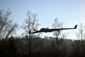
Drone surveys have been used for a number of years to enhance the data capture of a specific area or site using aerial imagery or video. This data can be used for many purposes in many industries including mapping, land surveying, construction site analysis, environmental monitoring, volumetric surveys and roof surveys. The process has been adopted in industries such as construction, agriculture and by many environmental agencies.
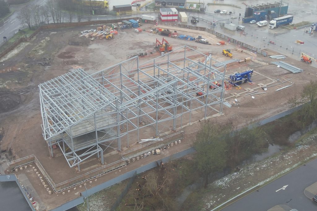
During drone surveys, the aircraft used will be equipped with a camera or other sensors designed to capture high-resolution imagery and data. A pre-determined flight path will be flown by the aircraft to capture the necessary data which will then be processed using specialist software to create detailed maps, 3D models and other visualisations of the data.
This method of surveying has many benefits. For example, a drone can cover a larger area in a shorter time-frame when compared to traditional surveying methods, and they can also provide more accurate and detailed data, especially in harder to reach areas which may pose safety issues when completed using traditional methods. With advances in drone technology, drone surveys are becoming increasingly popular and are expected to become the go-to surveying technique in the future.


Do you have a question? We are here to help. Submit your details below and we'll call you back. (Mon-Fri 9am - 5.30pm)
You need to have an RPC-L1 Aeroplane qualification to begin this course, as this will build upon the fundamentals of fixed wing flying to convert you to type on our impressive DeltaQuad Evo RPAS. What’s more, you will also learn how to use the exceptional Auterion Mission Planner, which is the brains of the operation when using DeltaQuad. This is a VLOS course only, although we have the ability to further expand on this into the BVLOS environment, provided the correct regulatory approvals are established. Experience this cutting-edge VTOL RPAS now and let us show you how it can further benefit your operations.
Our new 1-day Observers course is designed to expand your RPAS crewing capabilities and de-risk more complex operations through the provision of professionally qualified RPAS safety observers. Utilising proven aviation standards and procedures, our professional and
experienced instructors will guide you through the fundamentals of Crew Resource Management, crew communications, RPAS control and coordination and give you the practical experience you need to maximise the benefits of your RPAS for VLOS operations and beyond.
If you hold a valid GVC and want to convert to an RPC-L1 qualification in the same category of UAS, under the CAA you are exempt from conducting the theory elements of the course and may progress directly to the practical elements. Therefore, you simply need to book
onto either our conversion course or the practical days of a full RPC-L1 course (provided there is capacity to fit you in). This will provide you with the minimum of 2-hours flight instruction before you attempt the flight assessment. Proof of GVC validity will be required prior to conducting the training.
This course is designed to qualify you in either Rotorcraft or Aeroplane, noting that you only need to conduct the practical aspects of the course, provided you have successfully passed the full Level 1 course in the other discipline.
(Please note this does not include conversion onto our DeltaQuad platform; that is a bespoke course in its own right).